Raby

Life in the Tropics

About 330 million years ago – in the Carboniferous Period – the North Pennines lay under a shallow tropical sea. The remains of corals, shell-fish and crinoids accumulated on the seabed and eventually hardened into limestone. This is the layered grey rock in the lower half of the waterfall. If you look closely at the limestone by the viewpoint you may find fossil fragments. Sand and mud from vast deltas were periodically washed into the sea, hardening to become layers of sandstone and shale you can see along the path and half way up the waterfall.

Molten Rock

High Force is a great place to see the famous Whin Sill. This is a layer of a hard, dark rock called dolerite, known locally as ‘whinstone’. The Whin Sill formed about 295 million years ago, when molten rock at over 1000°C rose up from within the Earth and spread out between layers of limestone, sandstone and shale. The molten rock cooled and solidified underground to form a flat sheet of rock, known as a ‘sill’. After million of years of erosion the Whin Sill is now exposed at the Earth’s surface, forming dramatic landscape features such as High Force and nearby Holwick Scars.

Sculpted by Water

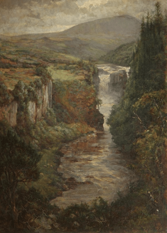
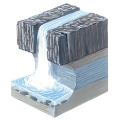
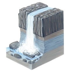
The gorge at High Force has been shaped by water – from the torrential meltwaters released at the end of the last ice age, to today’s River Tees. The hard rock of the Whin Sill forms a resistant lip over which the River Tees plunges. Over thousands of years the water erodes away the softer sandstone and limestone lower in the cliff, undercutting the Whin Sill. Blocks of it break off and the process starts again. In this way the waterfall is gradually retreating upstream. High Force has now reached this point on its slow journey up Teesdale – and it is still on the move!

High Force on the Move

waterfall cross section

The waterfall erodes the softer sandstone and limestone, undercutting the hard Whin Sill.

waterfall cross section

Blocks of the Whin Sill break off and the process starts again.